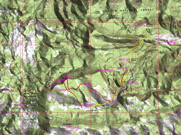
The Bridge Creek Wilderness is located in central Oregon in the Ochoco National Forest, east of Prineville. This relatively small wilderness contains some interesting natural and historic features and stunning views of the Cascade range. A three-dimensional map section viewed from the northeast shows the striking land form that gradually rises from the south to an 800' right-angled cliff at the north. The adventures in Bridge Creek Wilderness are divided into four tracks. Each track is shown on a map and on an aerial photo, with altitude profiles of the tracks and links to photographs of typical terrain. There are also GPS waypoints available for Track 1, Track 2, and Track 3 and 4 combined. To explore the tracks, click on the track shown on the map immediately below or on the menu below the map. |

| Track
1 Entry to North Pt |
Track
2 North Pt to old trail |
Track
3 Entry to Bridge Spring |
| The information on this site is provided and maintained by Scott Parker. For more information, e-mail info@scottadventure.com. This page was last updated on 5-23-05. |