| Bridge Creek Wilderness |
Bridge
Creek
Home |

|
|
Track
3 - Old Trail to Bridge Spring |
|
 |
| Track
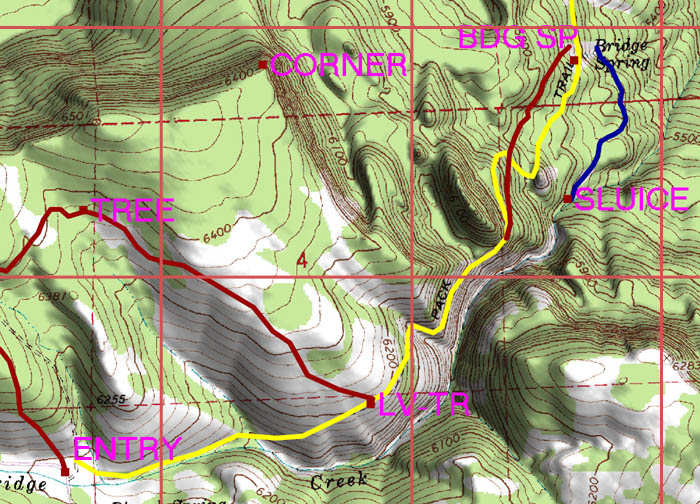
3 begins at the entry point and follows the Old Trail (yellow)
to Bridge Spring. From the point where Track 2 meets the old trail
the trail is easy to follow. After crossing an intermittant stream
and rounding a sharp ridge with notable rock outcrop, the trail
takes you across the face of a treacherous rock fall into a steep
canyon. A seep along the trail provides a bit of greenery in season.
A little north of the rockfall there is an alternate route (shown
in red on the right of the map), steeper but more direct than
the old trail, where the old trail has largely been lost due to
downed trees.Bridge Creek lies at the bottom of the canyon and
it is possible to descend from the intersection of the red and
yellow lines to see the creek partly diverted into a sluice (blue
line). The sluice can also be followed (with some difficulty if
it is full) to Bridge Spring. |
|
Altitude
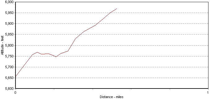
Profile for Track 3 and 4, Old Trail (all the way to Maxwell Reservoir) |
| |
| Altitude
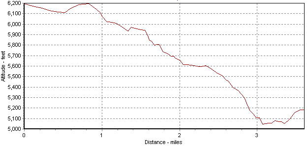
Profile for Track 3, Alternate Route Better than Old Trail |
 |
| The information
on this site is provided and maintained by Scott Parker. For more
information, e-mail info@scottparker.com.
This page was last updated on 5-23-05. |
|
| |


