| Bridge Creek Wilderness |
Bridge
Creek
Home |

|
|
Track
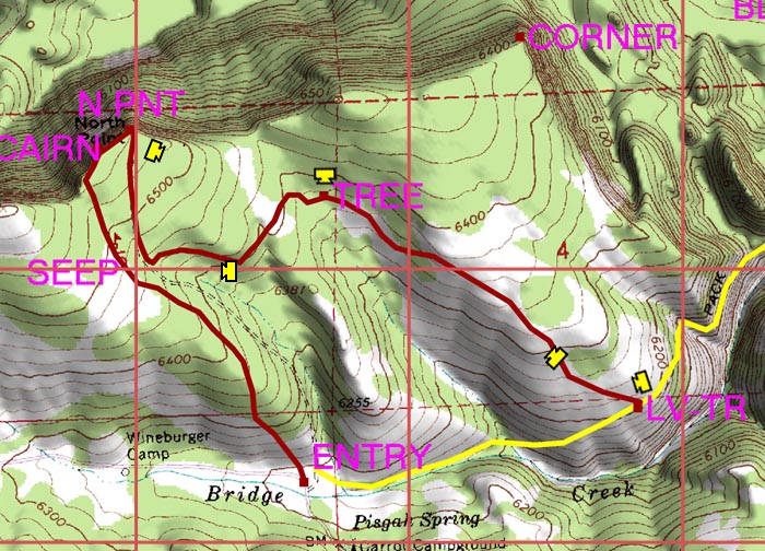
2 - North Point to the Old Trail |
|

|
| Track
2 begins at North Point and heads east and downhill mainly through
clearings and meadows to reach the old trail. |
|
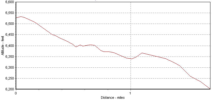
Altitude
Profile for Track 2 |
| |
| The information
on this site is provided and maintained by Scott Parker. For more
information, e-mail info@scottparker.com.
This page was last updated on 5-23-05. |
|
| |


