| Bridge Creek Wilderness |
Bridge
Creek
Home |

|
|
Track
1 - Entry to North Point |
|

|
| Track
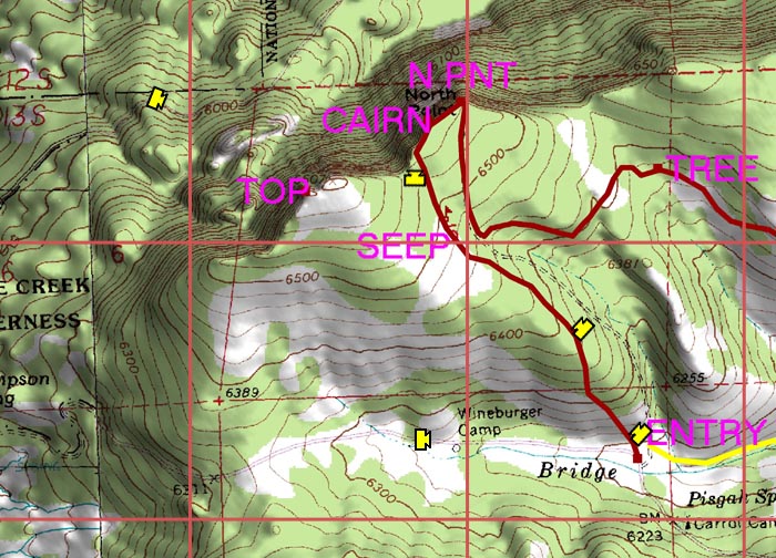
1 begins where the old road enters the wilderness. The old road
is not passable in the lower sections due to blowdown, and the
track takes an alternate route slightly to the west through clearings.
The track passes a seep where water was easily found in May. (In
July the water was more elusive but it was possible to pump water
for camping from a spot below the seep.) The track reaches the
cliff edge near a beautifully constructed cairn. Following the
cliff edge to the east brings you to North Point. |
|
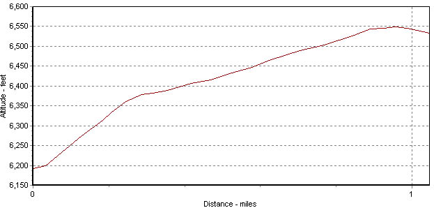
Altitude
Profile for Track 1 |
| |
| The information
on this site is provided and maintained by Scott Parker. For more
information, e-mail info@scottadventure.com.
This page was last updated on 5-23-05. |
|
| |


